Tag Archives: David Thompson

Summer Glamping in Golden… An Iconic Canadian Mountain Town

Standard

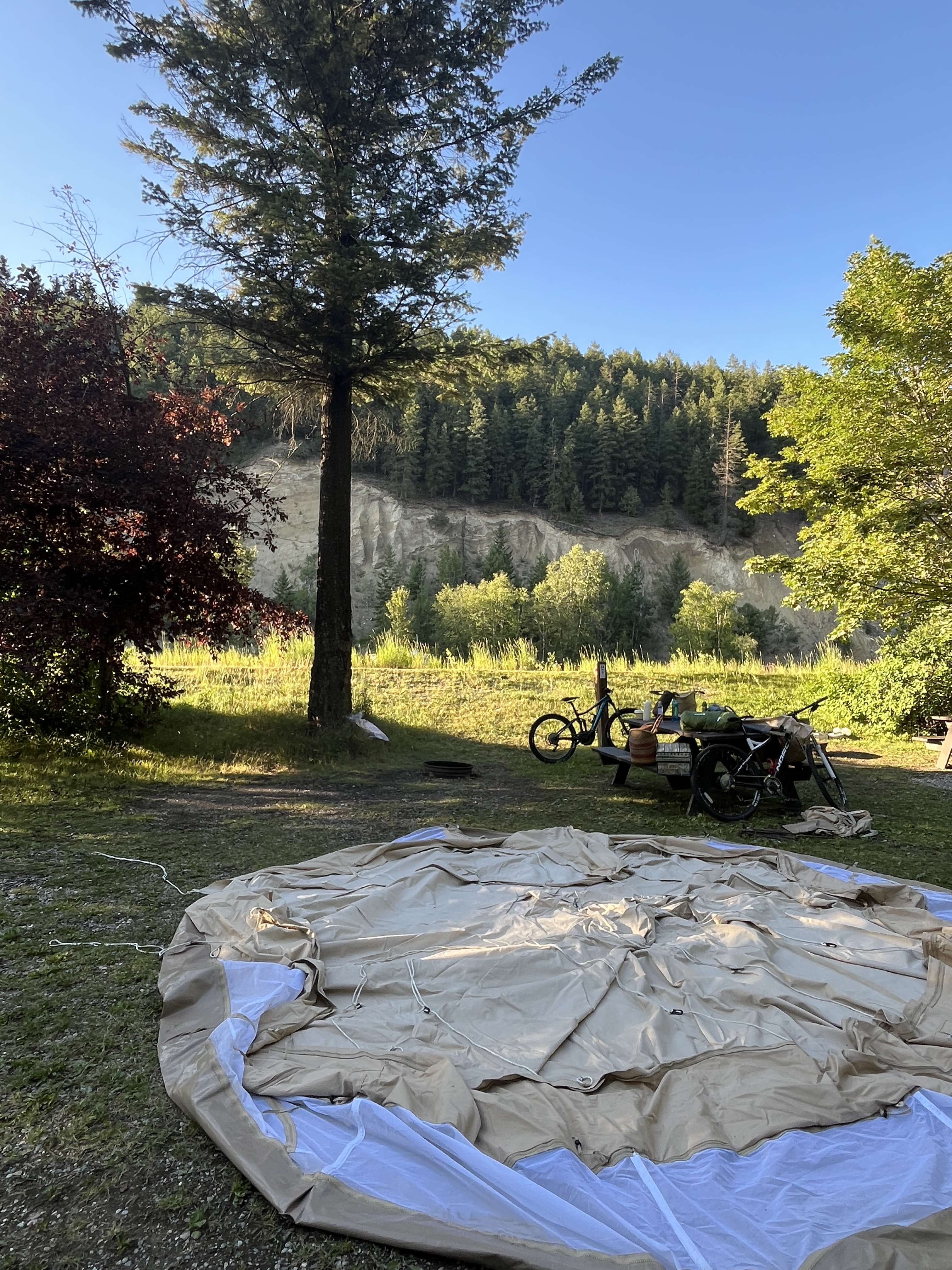
We call them mountain towns and nature has spoiled us with these veritable summer playgrounds. Nestled amongst majestic peaks and dazzling crystal-blue lakes and rivers, they’re gateways for hiking, biking, golfing, paddling, and camping. In our case glamping, as it comes with a dose of the glam with Lupin, our beloved Sibley Bell tent. With the car packed full to the gunnels, bikes and canoe strapped on, last month we chose a new mountain town to play in.

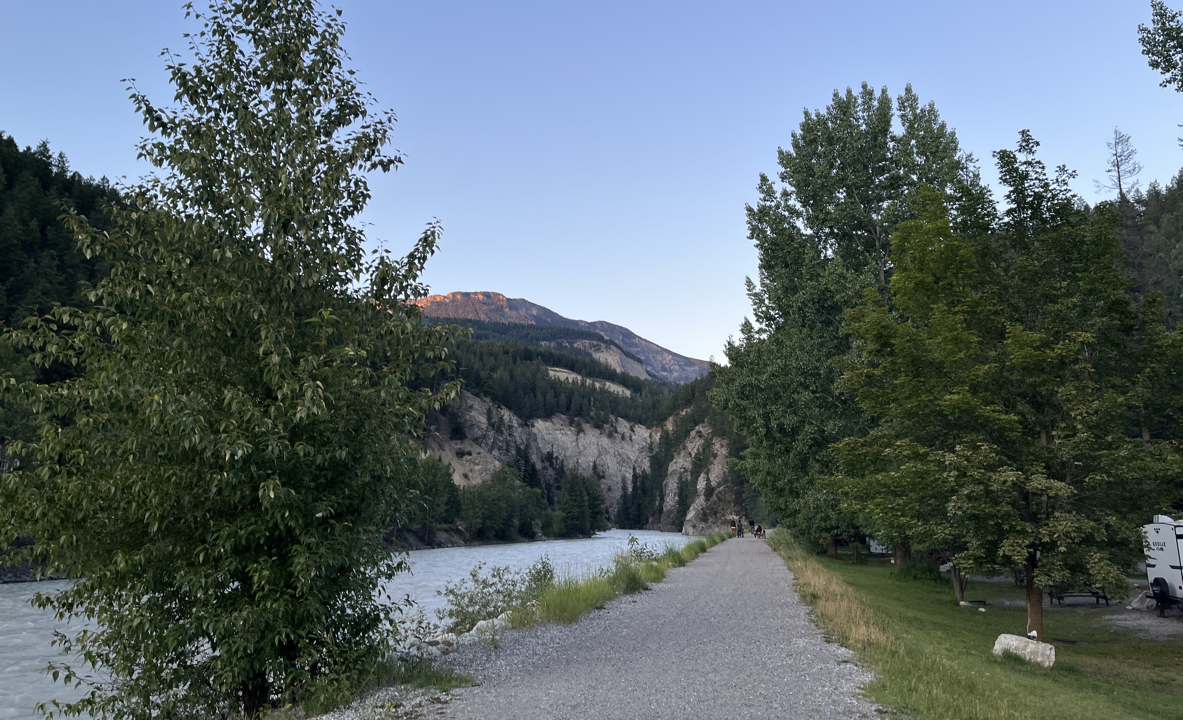
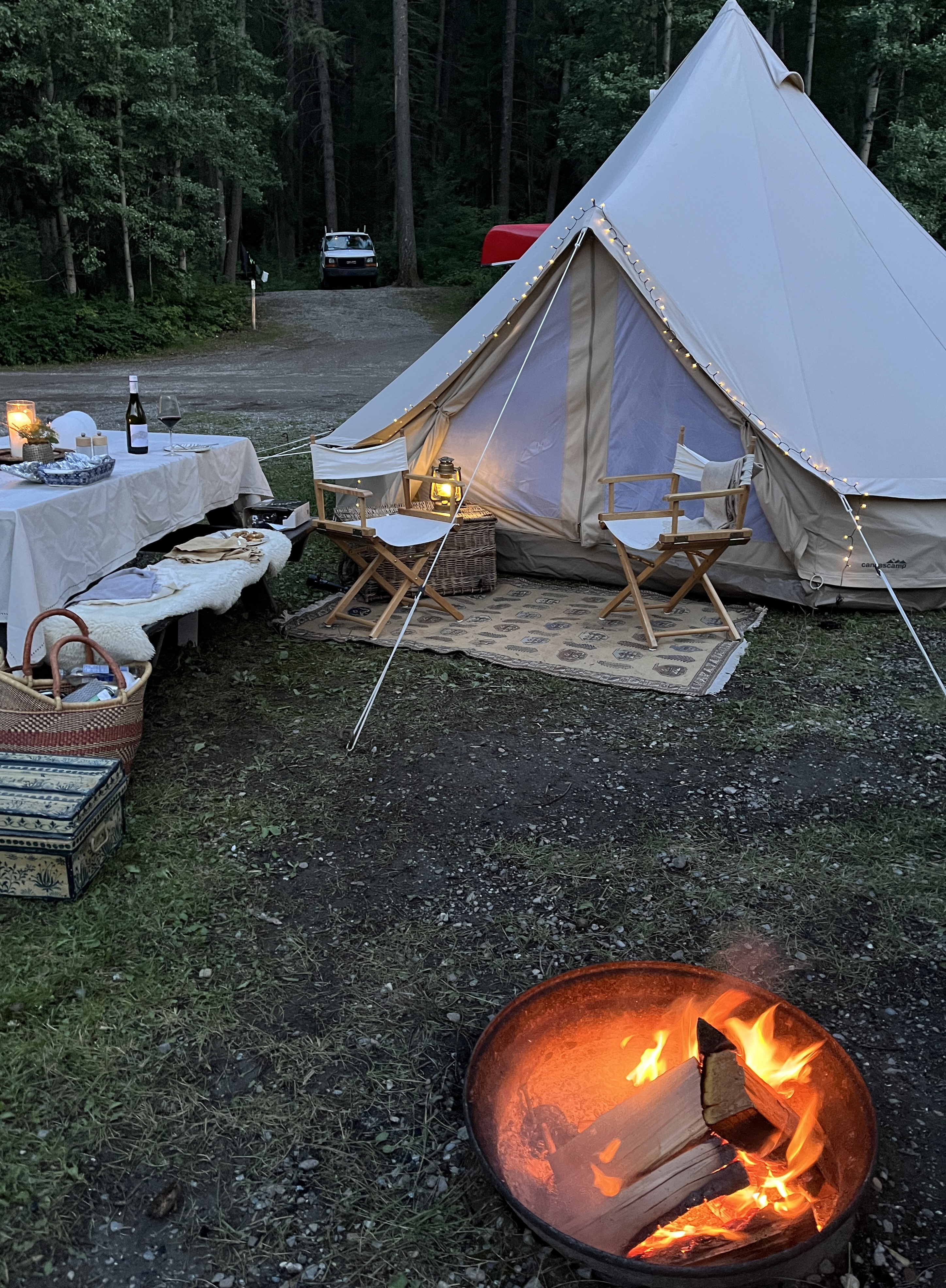
We often choose to stay in the heart of towns, in Municipal Campgrounds, as we did with our iconic glamp in Kaslo, near Nelson. In Golden, the choice graced us with a picturesque spot along the Kicking Horse River. Pesky mosquitoes were part of the welcome crew and with our site set up in about an hour, the campfire was soon crackling away, dinner and wine ensued. We savoured the slow unfolding of dusk and with the revelation of night upon us, we marvelled at a thousands stars in the twinkling sky above.

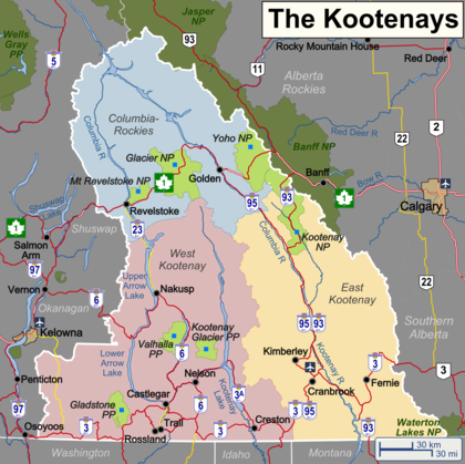
Nestled in the Rocky Mountain Trench, along the confluence of the Columbia and Kicking Horse Rivers, the town of Golden is surrounded by three different mountian ranges and five National Parks. Our camping spot was surrounded by other campers from the tiniest of tents, to grand trailers, to old-school camper trailers. It seemed that all of us – from the many Americans and overseas travellers, to fellow Canadians – were genuinely pleased just to be in the great outdoors, yet with amenities at our fingertips.

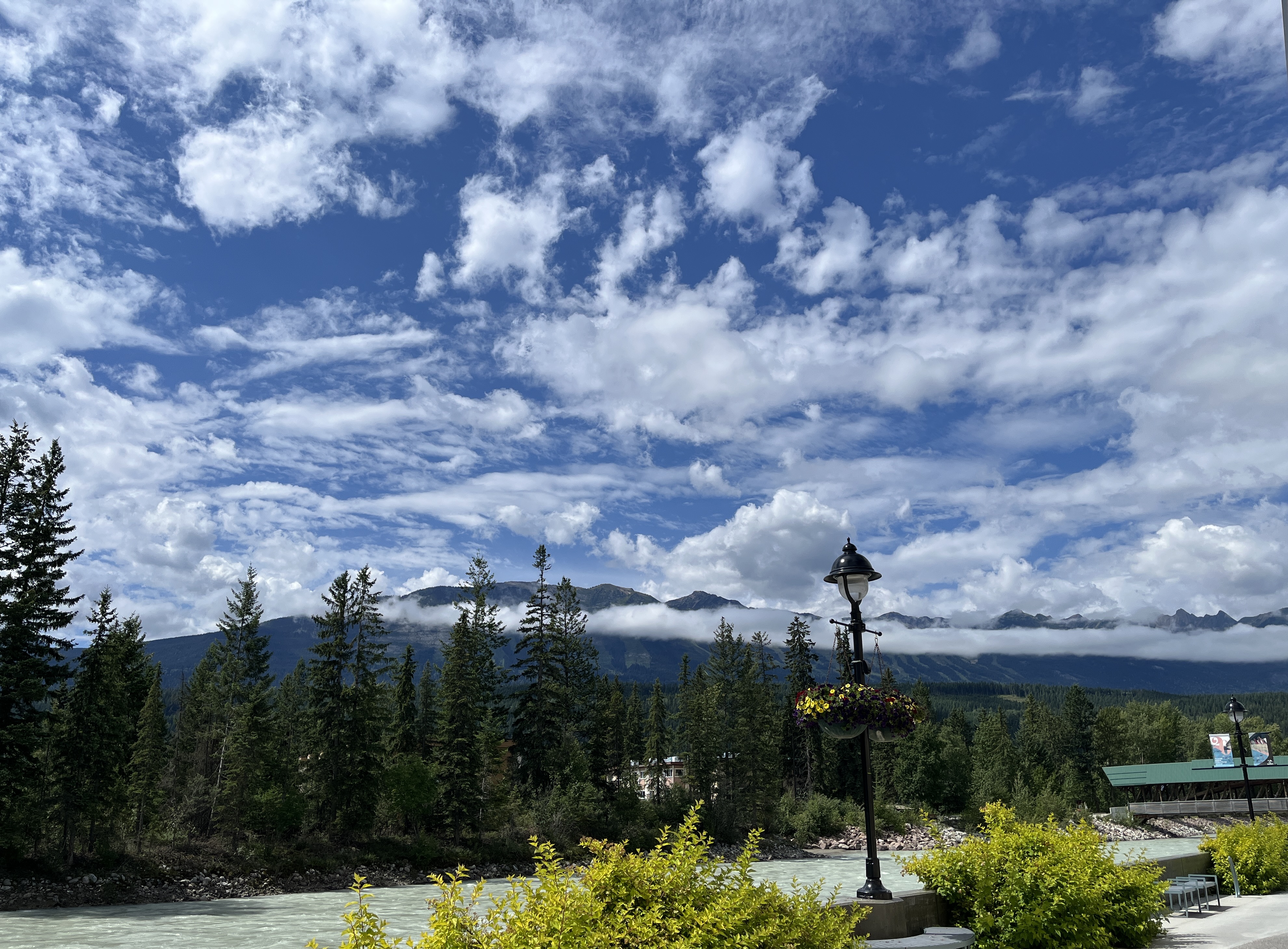
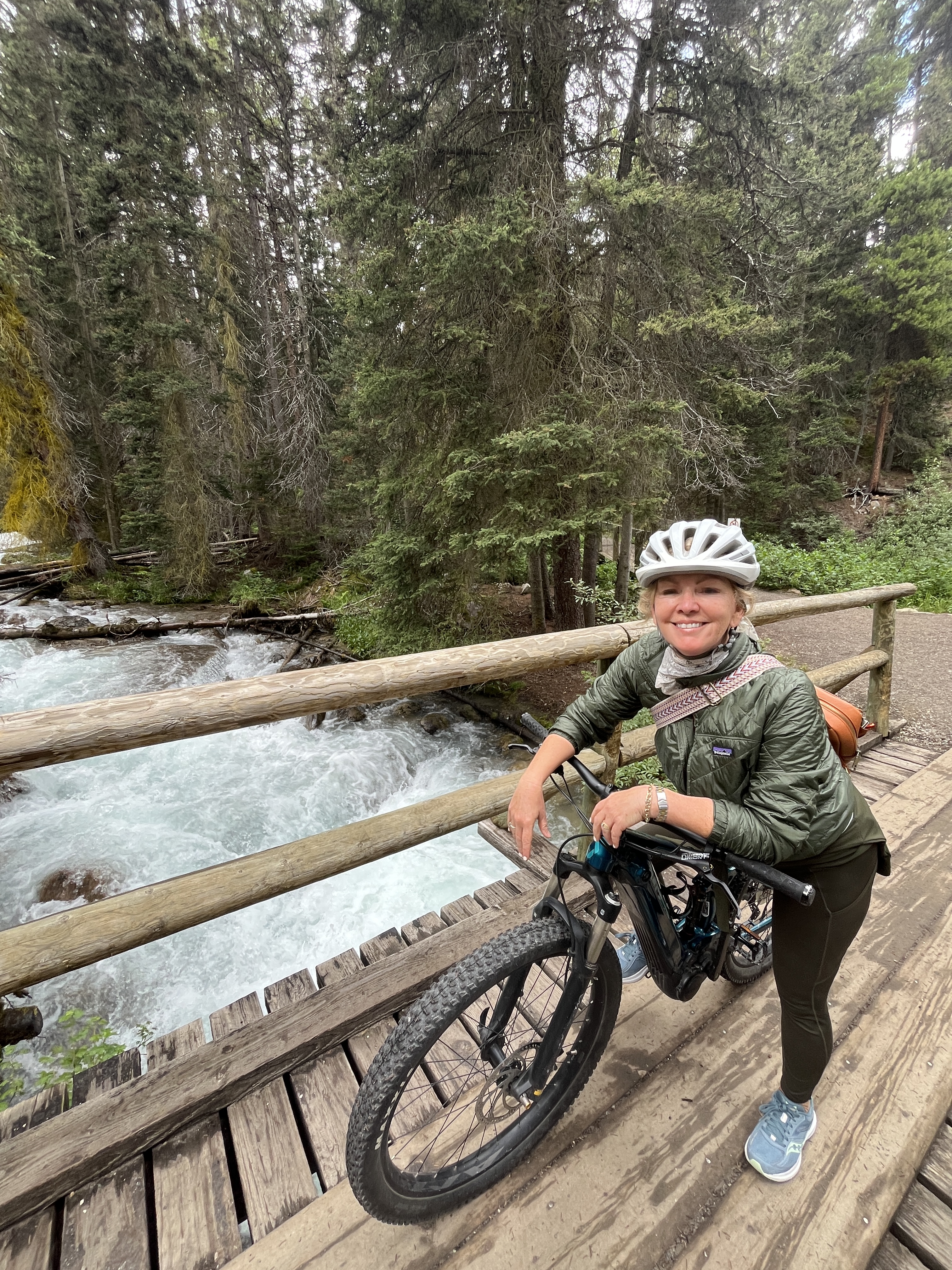
Each morning after coffee around the campfire, we’d set off on our bikes to explore the town. With its river running through it, Golden is bestowed with a stunning setting. The Kicking Horse Mountain Resort has an eagle eye’s view in the distance and a long promenade stretches alongside the river. Canada’s longest timber-framed bridge is its anchor.

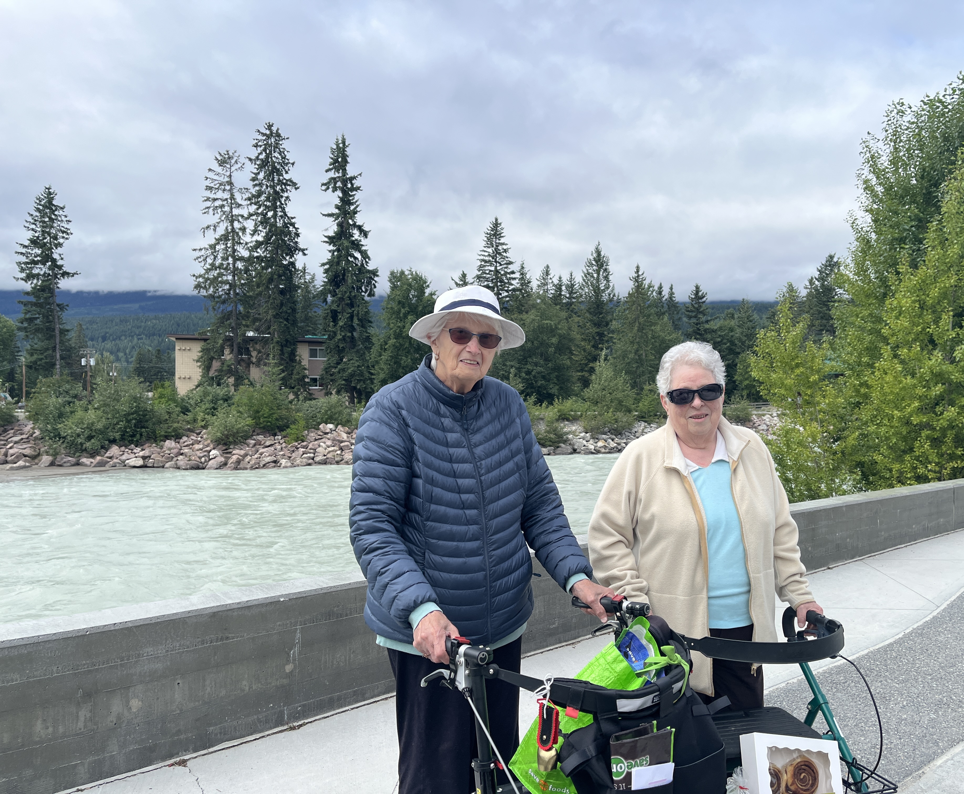
We chance upon Betty and Lynn out for a mid-morning stroll. “Such a beautiful spot for a morning walk,” I say with a smile. They immediately offer a sincere apologize,” We’re sorry that our mountain is hiding behind the clouds.”

“Oh I know it’s there,” I confirm, “your beloved ski hill is hiding! We’re from Kimberley, another ski hill town.”

“I was raised in Kimberley,” one of the ladies says fondly and from there our conversation flows.

The peaks soon reveal themselves in the unseasonably chilly morning and the ladies happily relate a few local stories of life here in the ’50’s.

“When we first arrived, there were only two telephones in the town and one of them was at my place… well you can imagine the commotion!” They admit the town has greatly changed as it’s now a world-class ski resort and hiking destination.

I‘ve written previously of the Swiss guides who first made Adventure Tourism possible in the area. The Canadian Pacific Railway brought the guides to the area in 1899. Earlier in that century, the renowned fur trader, surveyor and map maker David Thompson was tasked with opening a trading route to the Pacific Northwest. Navigating the vast and treacherous Rocky Mountains, he first travelled to the future site of Golden in 1807. It wasn’t until 1881 that the CPR hired A.B. Rogers to find a rail route through the region. The base camp established for his crew eventually first of the settlement now known as Golden.

The ladies tell me that the town was eventually named Golden. “It had to out-do nearby Silvertown.”

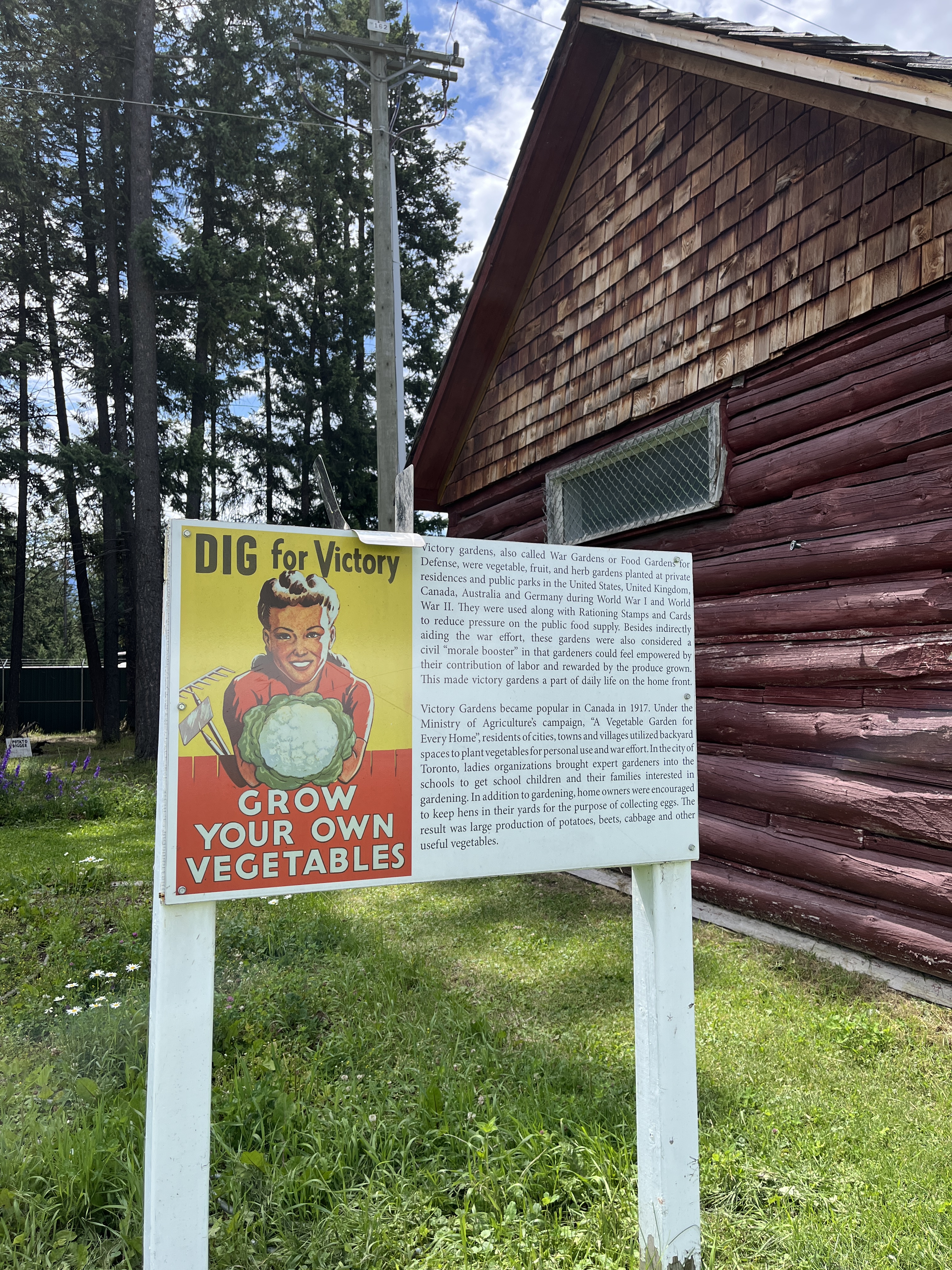
After our chat and a browse through the market, we cycle through the wide streets to the local Museum. It’s charming, full of information, and regals with stories about the original Columbia River Lumber Company which grew the settlement, while also attracting a large hard-working Sikh population. The Museum also pays homeage to Victory gardens, or war gardens, vital during the first World War; utilizing backyards for food, both for personal and the war effort. And of course there is much mention of the vital role those Swiss guides played.

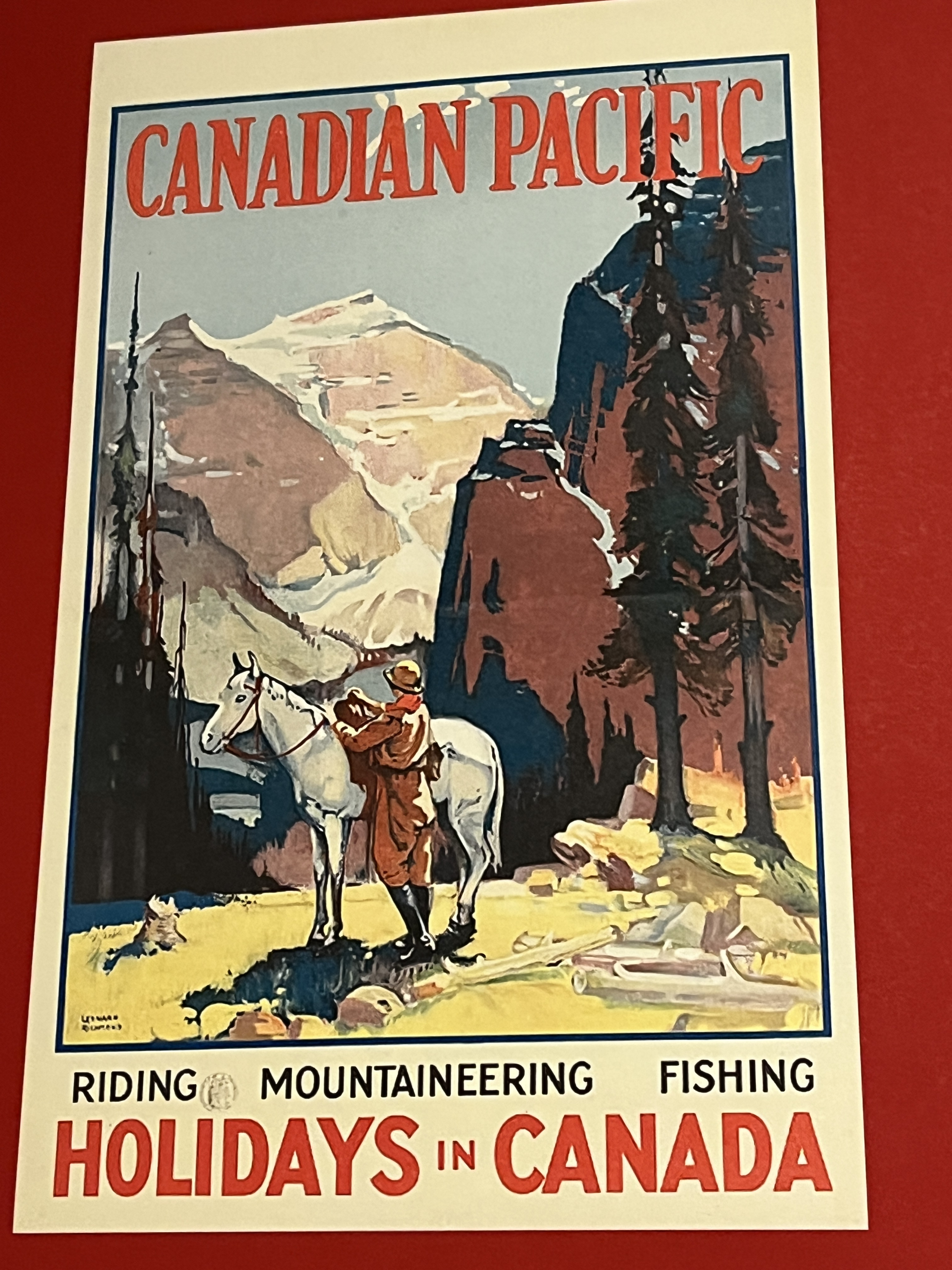
Swiss mountaineers were employed during the summers, returning home to Switzerland over the winter, most over-wintered working as caretakers for the seasonal CPR hotels. Of the fifty-six first ascents of mountains over 3000 metres prior to 1911, no fewer than 50 first ascents were made under the steady hand and sure foot of these experienced men. By 1925, CPR’s 35 Swiss Guides had led more than 250 first ascents in the mountains of western Canada. With no fatalities in their care, and perhaps basking in their reputation as gentlemen and colourful characters, many would bring their families to make their Golden home at the purpose-built Edelweiss Village.

We had visited their home-away-from-home a number of years ago, now it has greatly changed… refurbished, re-imagined and open to guests.

Our bike rides take us out of town, through forested trails, up and down mountains and on the last day to the famed Lake Louise… with a little driving in between. The beautiful drive from Golden to Lake Louise heads east, then south for about one hour through Yoho National Park. Stop at the Spiral Tunnels, the Golden Skybridge, Wapta Falls, Emerald Lake, or the sleepy but gloriously positioned town of Field.

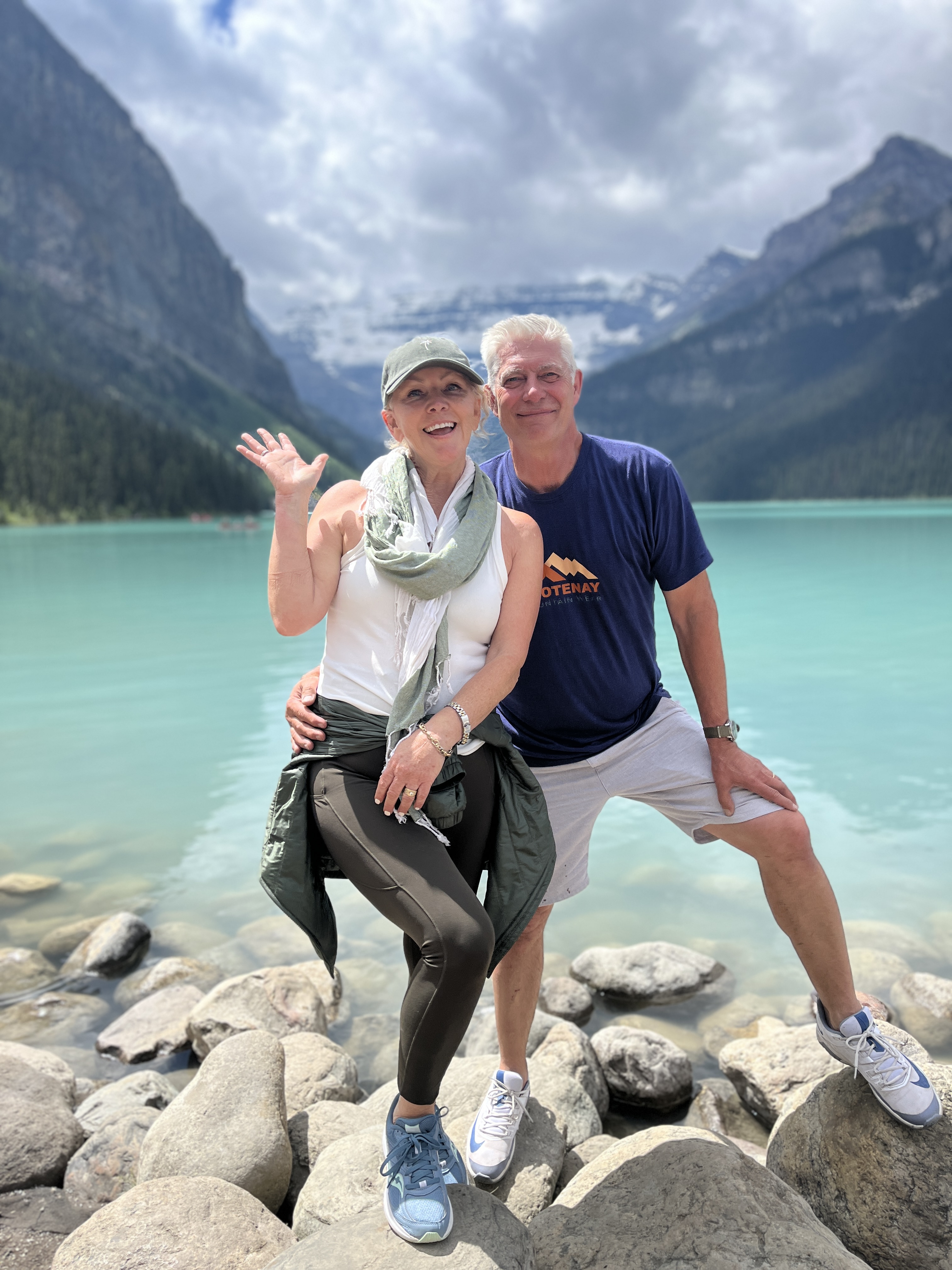
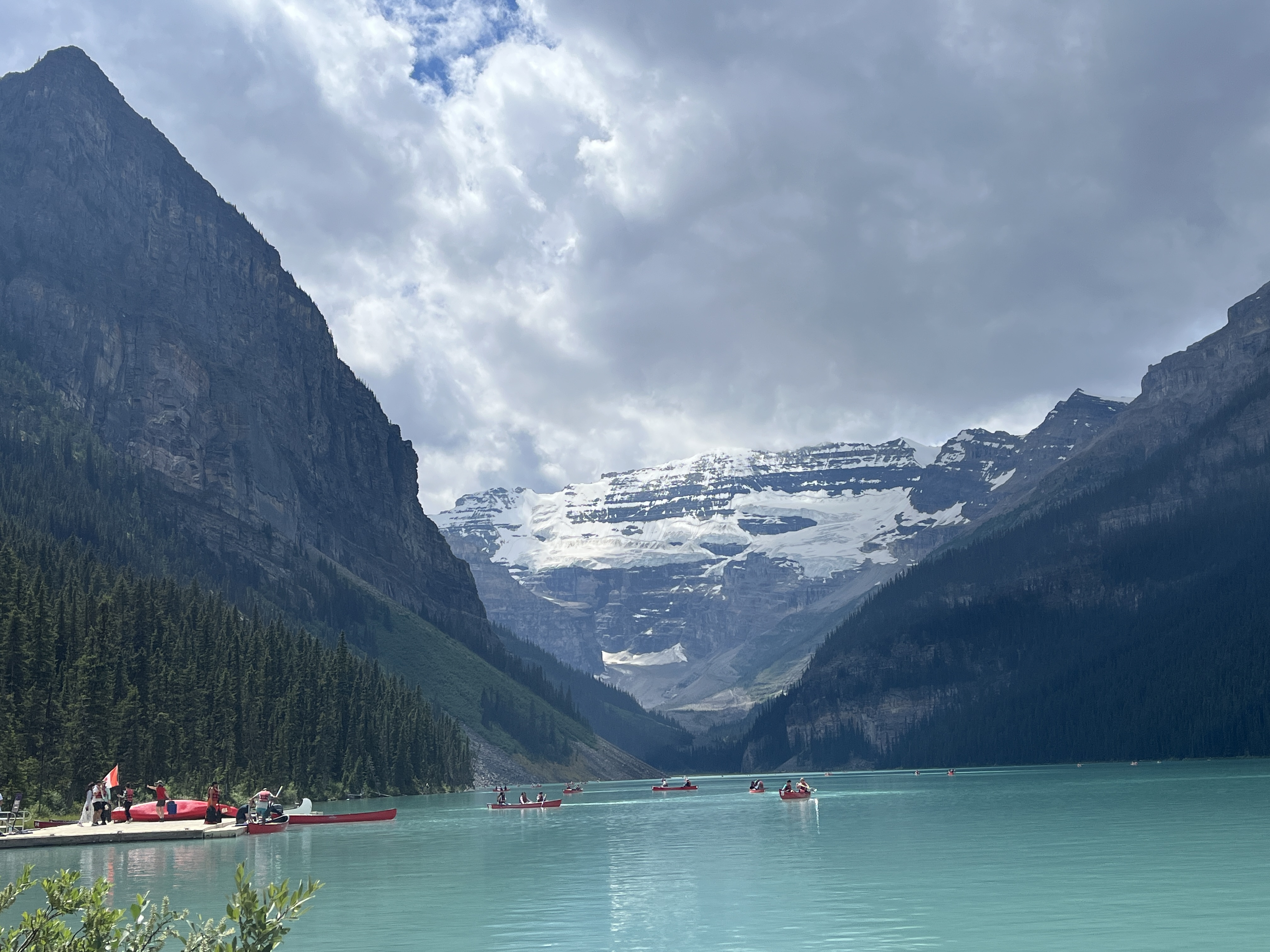
After parking in Lake Louise Village, we biked the former route of the tramway up to the lake – about 10 km both ways. The Tramline Trail leads you to one of Canada’s most breathtaking views. As always people have flocked from around the world to catch a glimpse of its iconic magic.

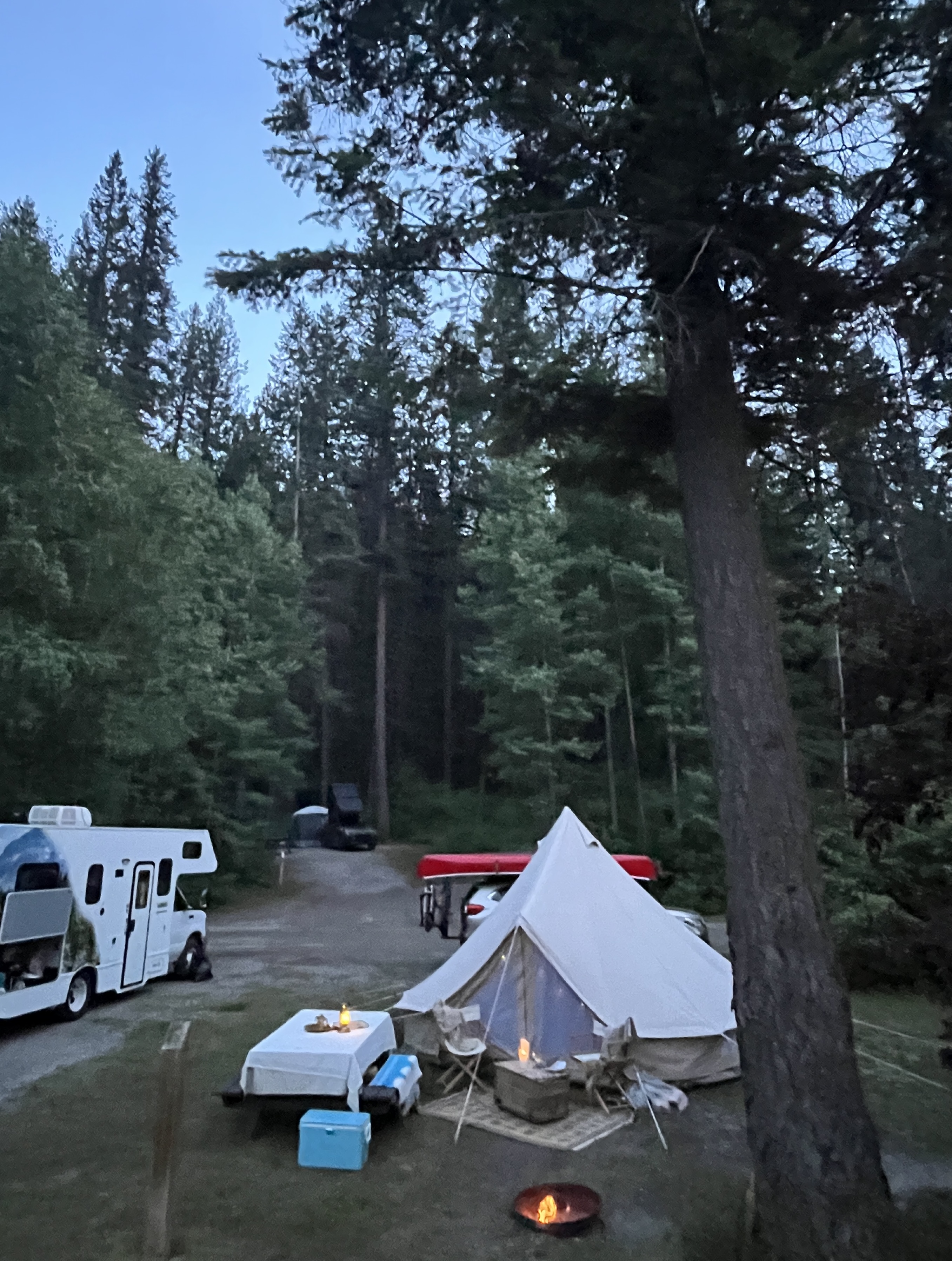
Back at the campsite on our last evening, a young father strolls past for a pre-bedtime walk with his children. “What a beautiful set-up, a bell tent. I know them well as I was in the military,” he tells me.

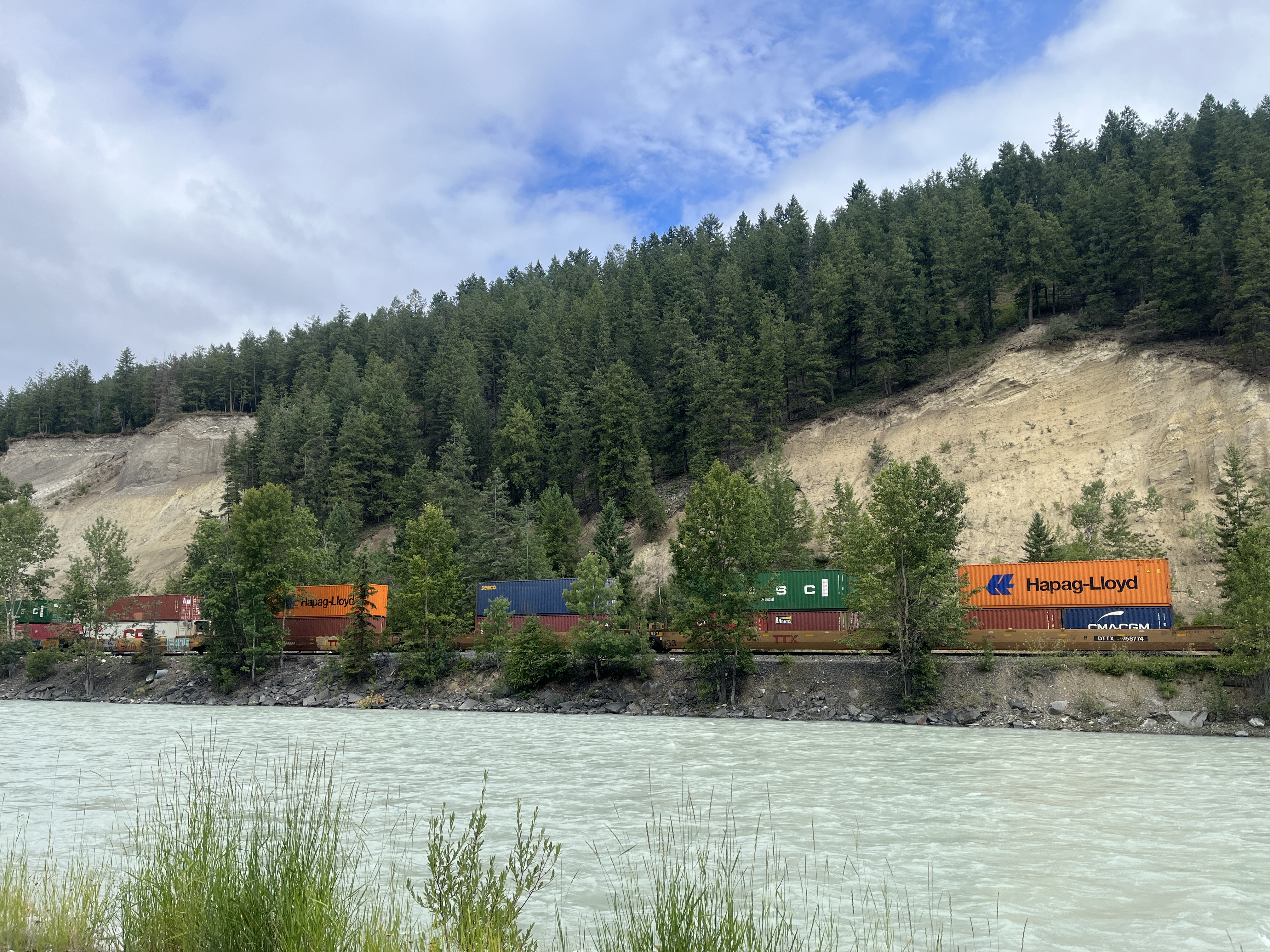
We’re used to compliments about our Lupin, she is always the ‘belle of the ball’ at any campsite. Dramatic on the outside, inside she’s cozy and warm. Shadows play on her canvas and the noises of the night may awaken you, but they accompany the scene like a grand outdoors sound track. Even the trains thundering past through the night, just on the other side of the river, weren’t bothersome but a tangible reminder of our vast country and the endless task of moving goods.

The Sibley Bell tent was invented by American military officer Henry Hopkins Sibley. Patented in 1856, the conical design stands about 3.7 metres high, 5.5 metres in diameter and can comfortably house about a dozen men. In our case, the most Lupin has slept is six adults and our grand-dog Captain… cozy indeed!

Roaming Close to Home… of Legacies, Lakes & Lilacs, part one

Standard

IMG_3525


With a special occasion at the end of June, we decided to invest in a tent and go glamping to celebrate… searching for the perfect camping spot was underway. Our plan had been to be in Europe for this milestone anniversary, yet the silver lining of Covid 19 has been the opportunity to discover and appreciate our own backyard. For many people, travel restrictions within their own region, province or state has created virtues from that unprecedented necessity. For us, it means a summer where home is our playground.

After months of isolation, we cruised the open roads in search of the perfect glamping spot. We are spoiled for choice. From our home in Kimberley, the East Kootenay region in the southeastern corner of British Columbia is graced with countless lakes. We steeped ourselves anew in the beauty of this region where jagged mountain peaks of the Rockies rise in parallel with those of the Purcells, Selkirks and Monashee ranges, valleys giving way to crystal clear rivers and lakes. Places where wooden docks host fishing, suntanning, boating and starting points for kayaking and standup paddle boarding. Where adirondack chairs sit poised for the long, hot days of summer.

While searching for the lake of our choice, we meandered down well-travelled roads and bounced along dusty back-country tracks. Narrow roads where cattle graze under serrated, snow-capped mountain peaks, where an unexpected turn might lead to cascading waterfalls, abandoned gold rush towns or meadows overbrimming with wildflowers.

As we cruised the mountain roads that day in search of ‘our spot’, we took the time to stop and appreciate those sites we always promise to, but rarely take the time to do so. Perhaps a chance to marvel at the iconic bridge over the Kootenay River or that outdated, yet charmingly retro campground sign at Skookumchuck that has always caught my eye. Skookumchuck is an Indigenous word that means ‘strong waters’. In local parlance, if something is skookum, it’s strong, impressive, or cool.

And finally, after years of driving past a wooden statue of a local Indigenous Chief, we stopped to ponder the past. Following the retreat of ice age glaciers ten thousand years ago, the Kootenay area of British Columbia was inhabited by the Kutenai or the Ktunaxa [Tun-ah-ha] people. I was fortunate to meet with Ktunaxa elders a number of years ago. I heard their legends and stories, their hopes for the future, of how they had endured the insult and outrage of the colonial residential school system. The arrival of the colonials forever changed the course of the Ktunaxa people and that past is particularly on display in this area. St. Euguene’s Mission, a residential school opened in 1890, still occupies their ancestral land. But today, St. Eugene’s is not only a hotel, casino and golf course, it stands proudly as a meeting place of reconciliation and healing.

4AC305F4-58AB-4811-8E28-21A246A5E900

In the early 1800’s, David Thompson, an explorer for the Hudson’s Bay Company, journeyed through this basin on his exploration of the Kootenay and Columbia Rivers. Thompson soon established trade with the Ktunaxa who were hunters, fishermen, gatherers… stewards of these beautiful lands. In the late 1860’s, the Galbraith family secured land in the basin, not from the Ktunaxa but from the nascent Provincial government, ranching and setting up the settlement of Galbraith’s Ferry to capitalize on the burgeoning gold rush trade. Fur traders, missionaries and settlers followed in their footsteps.

The Ktunaxa soon witnessed the appropriation of their homeland. Eventually, the stalwart protector Chief Isadore would protest “that all grazing land should remain free for all people to use, that no man had the right to erect fences.” As vast tracts of the Ktunaxa’s land disappeared to the railway, to the government and the colonists, it was clear there would be no return. Chief Isadore petitioned that the land allocated to his people was “unfair and unequitable“. In 1888 Colonel Sam Steele, stationed at Galbraith’s Landing (later renamed Fort Steele), played a role in mediating, convincing, and undoubtedly placating Isadore to accept the de-facto property rights of the Ktunaxa Nation’s very own ancestral homeland.

Of Chief Isadore, in his memoir ‘Forty Years in Canada’, Steele writes, “Isadore was the most influential chief I have known. Crowfoot, the Blackfoot chief, or Red Crow, dare not, in the height of their power, have exercised the discipline that Isadore did.” But, despite his disciplined and principled stance, Chief Isadore could not turn back the tide of change.

While writing this piece, we happen to cycle the Chief Isadore Trail. It follows portions of the once Crowsnest Railway Line, through the lost small station at Mayook, and onto Cranbrook which partly serviced Kimberley’s North Star and Sullivan lead and zinc mines. The trail roams through grasslands, ponderosa pine forests and saltgrass prairies. The lofty Rockies stand majestically over us.

We pass by ample serviceberries or saskatoon berries, once so essential to the Ktunaxa. They were eaten fresh, as flavour for fish and meat, or dried for trading in the winter months. The bark of the shrub was used as an eyewash to treat snow blindness. The hard straight stems to make arrows, tipi pegs, pipes and spears. I can almost feel the presence of the impressive and dignified Chief (standing centre in bottom photo) as he surveyed the land, lamenting its loss, attempting to reconcile his people to the future.

Chief Isadore would eventually withdraw to a piece of land on the Kootenay River, allocated to him by the Provincial authorities. Devoting his last years to improving his farm, influenza attacked his people during the winter of 1893-94. Many of the elderly succumbed. Chief Isadore was among them.

As the Ktunaxa land was eagerly purchased by Canadian and European newcomers the settlement of the valley gained momentum. Notable was Colonel James Baker who named the town Cranbrook, after his family estate in England. Baker was closely allied with the Canadian Pacific Railway (CPR), who in 1898, successfully convinced them to establish the Crowsnest Railway line through Cranbrook rather than Fort Steele. Baker would go on to play a prominent role in the politics of the region. Cranbrook was incorporated as a city in 1905. Baker had returned home to England in 1900, leaving his townsite business to his son.

My brief relating of this history should be a gentle reminder of what the Ktunaxa have lost and of their suffering. Their vision today is one of a strong, healthy community that proclaims and celebrates their heritage. As a self-governing, thriving Nation working to revitalise their language and culture, they take a leading role in the stewardship of their land. And, as I look across the broad valley of the Rocky Mountain trench, my understanding of what has gone before helps me treasure all the more, the privilege of sharing this land.

Framed by the Rockies and vast blue skies, the city of Cranbrook’s colonial roots are very much on display. Edwardian architecture of brick and sandstone speak to the city’s development throughout the early 1900’s. Original surviving buildings of the CPR, now the Canadian Museum of Rail Travel, pay homage to ‘how the west was built.’ Striking heritage homes in the Baker Hill area, nestle close to where Baker himself settled on the hilled area to the south and east of downtown.

What we noticed most on that late spring day in June, were the lilacs – so many beautiful lilacs! Profuse in colour and in their intoxicating scent, lilacs often flank the entrance or front gardens of earlier buildings in Canada. Whether in towns or on homesteads, lilacs seem to represent home, stability, and have coloured the landscape for generations.

Originally known as philadelphus, supposedly after an Egyptian King, they’ve been interpreted in many ways throughout history. The Celts saw lilacs as magical because of their sweet scent. During the Victorian age, lilacs were a symbol of an old love—widows often wore lilacs during this time. In Russia, holding a sprig of lilac over a newborn baby was thought to bring wisdom. I like to think that that they are markers of the complexity of Canadian heritage and history – embodying the hopes and dreams of the settlers and homeowners who planted them.

But I am meandering in much the same way that we had roamed on our mission of finding the ideal lake for camping. In going out into the land we had taken the proverbial time to ‘stop and smell the lilacs’, time to become better acquainted with and to embrace the local history that surrounds us.

Indeed, the silver lining of Covid these past months was the licence to be near, to better know our own neighbourhood without venturing far, and in the end we would choose none of the lakes we came upon. We decided that our first glamping experience should be where it was meant to be all along… at my parents acreage where our own history is firmly rooted. There, it wasn’t lilacs in bloom, but gorgeous peonys to perfume and help christen our inaugural glamping experience. To be continued…

420px-Kootenays_WV_regions_map_01